Real-Time Emergency Response
A project for the Mozilla Ignite Challenge
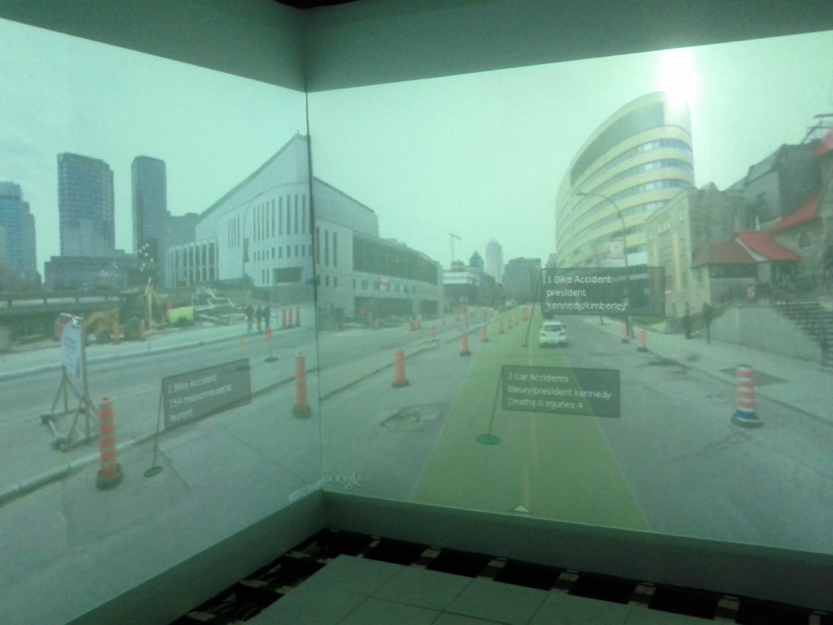
This project deals with the detection, observation, and assessment of situations requiring intervention by emergency responders, offering them access to high-quality “live” data that may be visualized effectively both by responders in-situ and by remote operators in dedicated control rooms. Its components include multimodal data registration, interactive visualization capabilities, and live streaming of the integrated contents.
Try out the prototype.
The rtER client app is available as an apk download for Android (low-frame rate for testing).
The iOS version is awaiting updates.
Note: the prototype runs on a development machine, which may go down for reboot, etc.
TEAM
- Jeremy Cooperstock
- Severin “Sparky” Smith
- Jeff Blum
- Alex Eichhorn
- Jan Anlauff
- Stephane Beniak
- Nehil Jain
- Stepan Salenikovich
FUNDING
PROJECT LINKS
- Mozilla Ignite entry
- Brainstorm round (gold prize winner)
- Understanding our Users
- Development Round #1 Blog
- Personas (credit J. Model)
- Software Data Flow
INSPIRATION
Scenario #1
The scenario below, loosely based on actual events during and after Hurricane Sandy, illustrates how our rtER app would be used.
We envision the rtER smartphone application installed on the phones of people in the National Guard, military reservists, etc., who have some background in emergency response, and who know how to keep themselves safe in a disaster area. Further video would be streamed from the public via other applications, but would lack the guidance system shown in our demonstration video. Assuming a pre-existing communications network (or an alternative channel) can be kept operating, our rtER technology will help improve detection and response time in such critical events requiring urgent attention.
Tuesday, October 30, 2012
The worst of Hurricane Sandy has already passed through New York City the evening before, leaving widespread damage. The VOST network has been monitoring the damage all night, feeding information to the Public Information Officer (PIO) at an emergency response centre. With the first responders stretched thin dealing with immediate crises, the VOST are key in planning and coordinating the first relief efforts and keeping the public informed and up to date.
At approximately 3 am, part of the VOST team is tasked with monitoring the Breezy Point neighborhood, which was flooded, and where dozens of homes are now burning, with a response of over 190 firefighters trying to contain the blaze where approximately 100 homes will be burned to the ground (National Post | NBC News).
Communications were poor and disorganized:
“Across a flooded parking lot, Jack O’Meara and his wife, Aileen, were waving flashlights to alert the firefighters.”
Local firefighters were unable to respond effectively:
“The community’s third company of volunteers, 10 men from the Volunteer Fire Department of Roxbury… were on the second floor of their firehouse, driven upstairs by the flood. Their fire trucks sat in four feet of water. All the radios were down, the phones dead.”
Challenges included:
- Even with communications, prioritizing and directing rescue efforts was difficult.
- Trained responders could not communicate their status or know how best to participate.
- People were in danger over a flooded and burning area the size of two football fields.
- Citizens were unaware of help/resources and felt abandoned.
How rtER Helps
Assuming the cell network (or an alternative channel) can be kept operating, rtER could help as follows:
Volunteers Violet and Victor, monitoring Breezy Point, see:
- Twitter feeds filtered geographically (#BreezyPoint).
- Video feeds, visualized on a map and grid, sortable by priority.
Example: Violet spots a tweet reporting fire. She correlates it with live video from a Roxbury firefighter using rtER. She drags it to top priority and alerts Victor, who identifies a safe parking lot via Anne’s video feed.
Victor messages the PIO with links to the video and safe staging area. The PIO, viewing on an immersive display, directs responders there. Violet then replies to tweets from stranded citizens, guiding them to the staging area.
Scenario #2
In January 2013, a 48-inch water main broke through McGill campus, flooding streets and creating black ice. The campus was almost surrounded by water, making it difficult to leave.
Jeff, leaving just after the break, found it hard to assess spread of flooding without wading through knee-deep water. Many students posted photos/videos online, but without filtering it was overwhelming.
rtER could have helped by:
- Visualizing posts geographically on the map.
- Filtering content to quickly confirm safe routes.
- Promoting useful information (e.g. safe passages) above dramatic but less helpful footage.
Roadmap
The long-term goal: manage multimodal data (video cameras, smartphones, audio feeds, social media) to support responders and operations centers.
Round 1: prototype immersive visualization for the Emergency Operations Center.
Round 2: focus shifted to team-based data management, informed by Virtual Operations Support Teams (VOSTs), who collate/filter data before it overwhelms emergency coordinators.
Quotes:
- “During large-scale events millions of posts, pictures and videos are added daily. How can a small agency sort through all of that?” — Kim Stephens
- “I’m way too busy to watch the internet. Prior to VOST, we simply wouldn’t listen to the community…” — Cheryl Bledsoe
Future: leverage crowdsourced public video with VOSTs filtering, enabling responders to scale.
Technology Development
Core components:
- Android app to capture/stream video.
- Server storing video streams + metadata.
- Web client for collaborative sorting/curation.
Round 3: expanded with video streaming, iOS port, and new features.
Use case: a smartphone user streams video → appears as live tile for VOST volunteers → sorted by relevance. Volunteers can promote/dismiss feeds, filter by map location, or request camera reorientation (compass/arrow feedback).